Lycian Coast: Fethiye to Antalya
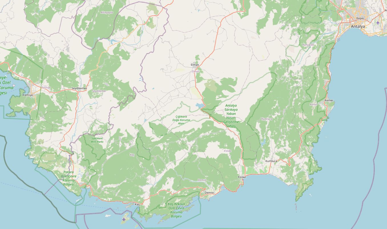
The D400 between Fethiye and Antalya is the coast road most riders come to Türkiye for. It runs past the ancient Lycian cities, drops to the sea above Kaputaş beach, and twice leaves the shore to climb into the hills before ending in Antalya.
The whole route is paved. Fuel is never far away, so the only planning it needs is where to stop for the night. Kaş, roughly a third of the way, splits it into a short first day and a longer second one.
Along the way
- FethiyeHarbour town and start of the route. The road south runs inland through farmland before reaching the coast.
- XanthosThe ancient Lycian capital sits beside the road at Kınık. Together with nearby Letoon it is a UNESCO World Heritage Site.
- PataraA short turn off the main road leads to a long sandy beach backed by ruins.
- Kalkan and KaputaşPast the hillside village of Kalkan the road hangs above the sea. Kaputaş beach is reached by steps straight down from the road; parking along the verge is tight.
- KaşSmall harbour town with an ancient theatre above the sea. The natural overnight stop.
- Kaş to DemreThe road turns inland and climbs to about 615 m, the highest point of the route, before dropping to the plain.
- DemreMyra's rock-cut tombs and the Church of St Nicholas are both a few minutes from the road.
- Finike and KumlucaFlat, fast sections through citrus groves and greenhouses.
- Kumluca to KemerA second climb, to about 570 m through pine forest, passing the turn for Olympos and Çıralı.
- Kemer to AntalyaThe last stretch is a busy dual carriageway with heavy summer traffic.
Elevation profile
Green ticks mark fuel stations. Hover the chart to read the height at any point.
60 fuel stations sit within 400 m of the road. The longest stretch without one is 35.4 km, between km 116.6 and 152.0 (Kaş to Demre). Any bike with a normal tank covers that without planning.
- 35.4 km (km 116.6–152.0)
- 33.4 km (km 72.8–106.2)
- 26.6 km (km 152.0–178.6)
Stages
| Section | km | Time |
|---|---|---|
| Day 1: Fethiye → Kaş | 106.3 | 1 h 41 min |
| Fethiye → Kalkan | 79.6 | 1 h 16 min |
| Kalkan → Kaş | 26.7 | 0 h 25 min |
| Day 2: Kaş → Antalya | 184.9 | 2 h 36 min |
| Kaş → Demre | 45.9 | 0 h 43 min |
| Demre → Kemer | 94.8 | 1 h 13 min |
| Kemer → Antalya | 44.2 | 0 h 40 min |
When to ride
Rideable all year. Midday heat is hard in July and August; winter brings rain and cool mornings.
Fuel cost
Default price: Antalya petrol, 2 October 2026.
GPS track
The full route as a GPX file, for Garmin, Calimoto, Kurviger and most navigation apps.
Download GPXMeasured: 1 November 2026